Peru:
Essential Facts, Geography & Basic Travel Information
Short answer: Peru is the third-largest country in South America, home to roughly 34 million people, and split into three geographic zones that couldn't be more different from each other — a narrow desert coast, the high Andes, and dense Amazon rainforest covering over half the country. This guide covers the facts every first-time visitor actually needs: where Peru sits on the map, what language and currency to expect, the basic history behind the country you're about to explore, and the handful of things almost every traveler gets wrong before they arrive.
Where Is Peru? Location & Borders
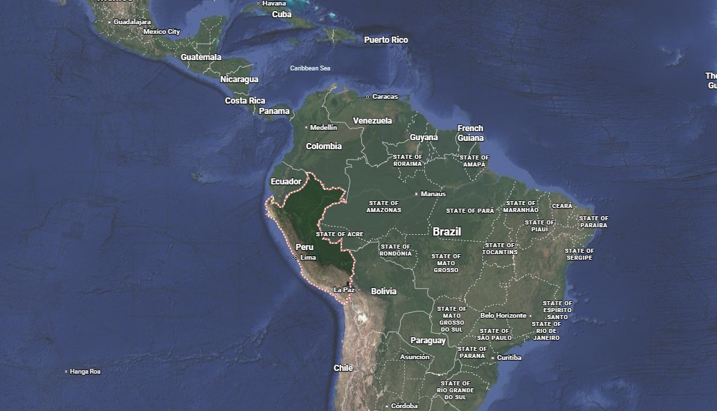
Peru sits on the western edge of South America, facing the Pacific Ocean. It's the third-largest country on the continent by land area, after Brazil and Argentina, and shares land borders with five countries: Ecuador and Colombia to the north, Brazil to the east, and Bolivia and Chile to the south. That combination — ocean on one side, jungle and Andean neighbors on the other — is a big part of why Peru's geography is so varied within a single country.
Peru sits entirely within a single time zone, five hours behind UTC, and doesn't observe daylight saving, so the time difference from any given country stays consistent year-round.

Peru's Three Regions: Costa, Sierra & Selva
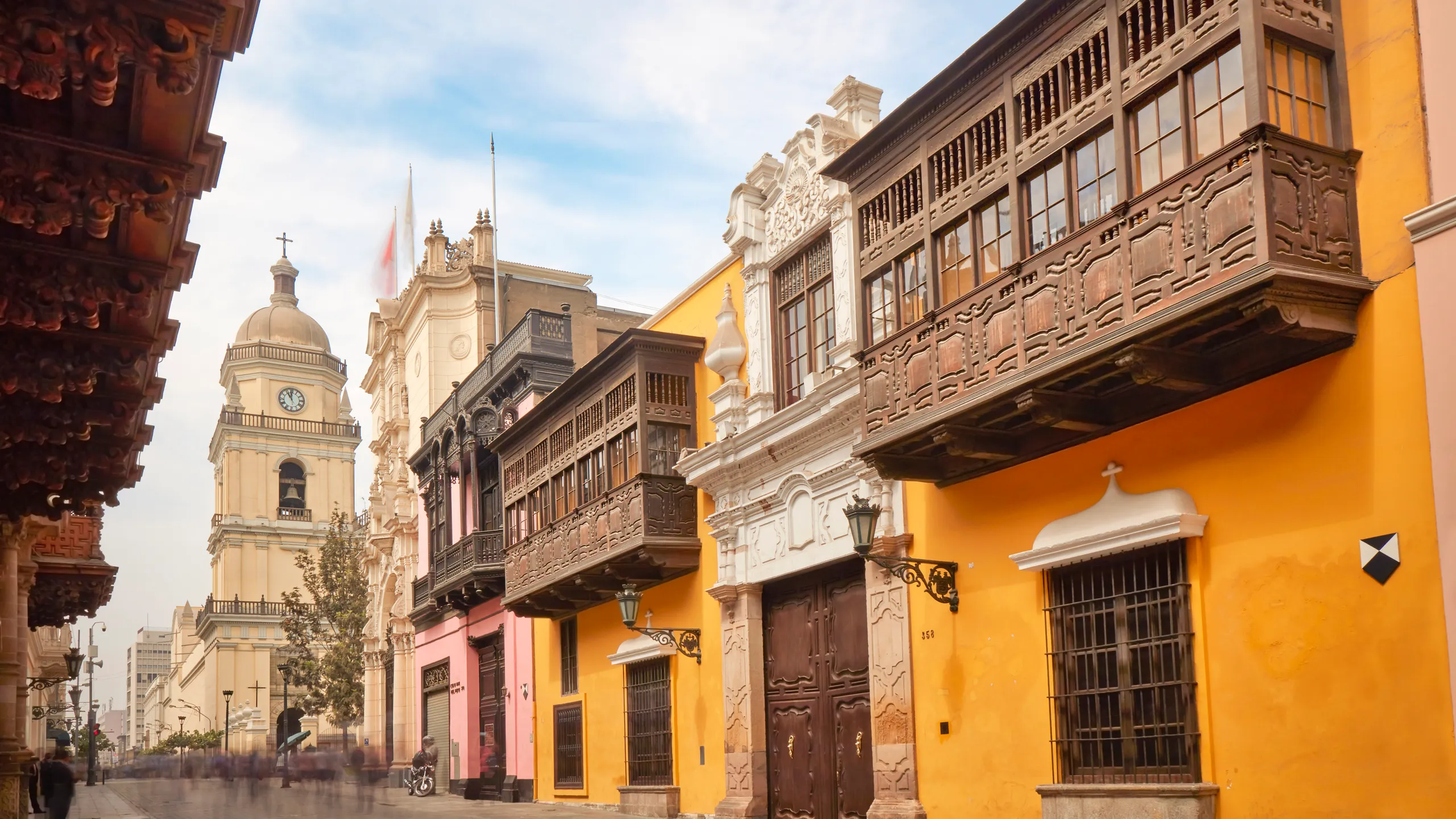
Most of what makes Peru feel like several countries in one comes down to three sharply distinct geographic zones. The Costa is a narrow, largely desert coastal strip running the length of the country, home to Lima and most of Peru's largest cities — dry, often overcast in winter (locals call Lima's grey coastal fog "garúa"), and geologically almost nothing like what most people picture when they imagine Peru.
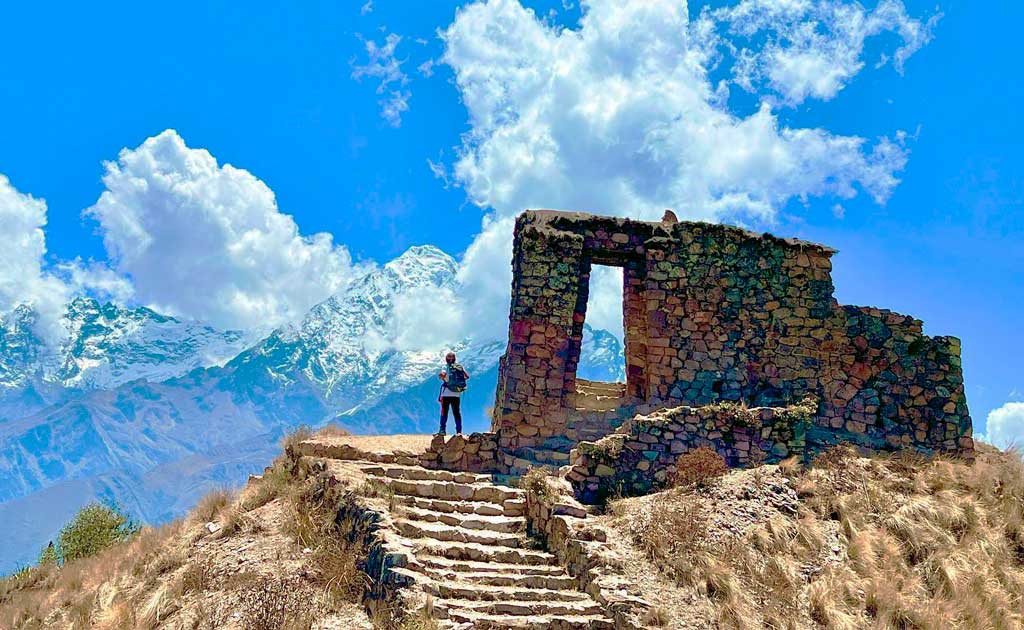
The Sierra is the Andean highlands — the Peru of postcards, home to Cusco, the Sacred Valley, and Lake Titicaca, with elevations regularly above 3,000 meters and a much more dramatic, mountainous landscape. The Selva is Amazon rainforest, covering roughly 60% of Peru's total land area despite holding a much smaller share of its population, and it's genuinely a different world — hot, humid, and biologically among the richest regions on Earth.
A lot of first-time visitors don't realize how quickly you can move between all three. It's entirely possible to be on a Lima beach in the morning and acclimatizing in Cusco's mountain air the same evening — which is exactly why altitude planning matters so much on a Peru itinerary.
Language & Currency: What You'll Actually Need
Spanish is Peru's dominant language and the one you'll need for the vast majority of interactions — restaurants, transport, markets, hotels. Quechua and Aymara are also constitutionally recognized official languages, spoken primarily in Andean highland communities; you'll hear Quechua regularly around Cusco and the Sacred Valley, and many guides and locals there are genuinely bilingual.
The Peruvian Sol (PEN, symbol S/) is the official currency. US dollars are widely accepted for larger expenses — tours, hotels, higher-end restaurants — but small vendors, local eateries, and markets expect Soles, and having cash on hand matters more in Peru than in many other travel destinations. Our Peru Currency Guide covers exchange rates, ATM tips, and how much cash to carry day to day.
A Brief History of Peru
Peru's history stretches back much further than the Inca Empire most visitors come to see. The Caral civilization, dated to roughly 3000 BCE, is considered one of the oldest complex societies in the Americas, predating the Inca by thousands of years. Peru is home to dozens of pre-Inca cultures before the Inca Empire — known as Tahuantinsuyu — rose to dominance in the 15th century, eventually stretching from modern-day Colombia to Chile.
Spanish conquistador Francisco Pizarro arrived in 1532, and the Spanish crown established the Viceroyalty of Peru shortly after, ruling the region for nearly 300 years. Peru declared independence on July 28, 1821, though Spanish royalist forces held out in parts of the country until their defeat at the Battle of Ayacucho in 1824 — the moment historians generally treat as Spanish colonial rule's true end in South America.
For the deeper story of the empire that built Machu Picchu and Cusco's famous stonework, see our complete guide to the Inca Empire.
- Tahuantinsuyu
- — the Inca Empire's own name for itself, meaning roughly "the four regions together."
- Sierra
- — Peru's Andean highland region, including Cusco and Lake Titicaca.
- Selva
- — Peru's Amazon rainforest region, covering roughly 60% of the country.
- Sol (PEN)
- — Peru's official currency, symbol S/.
- Quechua
- — an official language of Peru, spoken widely in the Andean highlands.
Common Myths About Peru, Corrected
| Myth | Fact |
|---|---|
| Cusco is Peru's capital | Lima has been the capital since 1535 — Cusco was the Inca capital, centuries earlier and under a different empire entirely. |
| Everyone in Peru speaks Quechua | Spanish is the dominant language nationwide; Quechua is common in Andean highland communities but not the primary language most Peruvians use day to day. |
| Peru is part of Central America | Peru is in South America, on the continent's western coast — not to be confused with Central American countries further north. |
| Peru is mostly jungle | The Amazon (Selva) covers roughly 60% of the land area, but the majority of Peru's population lives on the narrow coastal Costa strip. |
Explore Peru's Regions in Detail
This page is the starting point — the regions and cities below are where the actual trip planning happens. If Lima is on your route, our complete Lima travel guide covers the capital's neighborhoods, food scene, and how to spend a day or two there. Heading to the highlands, our complete Cusco travel guide is the natural next stop, covering the gateway city to Machu Picchu and the Sacred Valley.
Many travelers extend south from Cusco to Lake Titicaca and Puno, the world's highest navigable lake and one of the most striking parts of southern Peru. For the culture behind what you'll see in the Andes, our guide to the Inca Empire explains the civilization that built Machu Picchu and Cusco's stonework, and our piece on what a quipu is covers one of their most fascinating inventions. On the food side, our Peruvian cuisine guide is the best place to start before you eat your way through the country.
Let our local team help you map it out.
Common Mistakes First-Time Visitors Make About Peru
Assuming Lima and Cusco share the same climate
Lima is coastal and mild; Cusco sits at roughly 3,400 meters and can be near-freezing at night, even in the dry season. Pack layers for both, not just one.
Not carrying enough cash
Cards work in cities, but markets, small restaurants, and rural areas run on cash. Carry Soles, not just dollars — see our currency guide for specifics.
Underestimating the size of the country
Peru is enormous — flying from Lima to Cusco takes about 90 minutes, and reaching the Amazon or Lake Titicaca adds real travel time. Don't assume everything is a short drive apart.
Assuming Spanish alone gets you everywhere
It gets you almost everywhere, but in remote Andean or Amazon communities, some locals are more comfortable in Quechua or another native language than Spanish.
Conclusion
Peru rewards a little homework before you land — knowing that Lima, not Cusco, is the capital, that you'll cross three genuinely different climates on a single trip, and that cash matters more than you'd expect all change how you pack and plan. Everything else, from picking a region to building an itinerary, gets easier once these basics are settled.
Ready to start planning where to actually go? Get in touch with our team, or dive into our regional guides starting with Cusco or Lima.