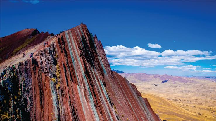
Short answer: Pallay Punchu is Cusco's third, quietest, and arguably most dramatic rainbow mountain — a jagged, poncho-striped ridge above Laguna Langui that most travellers have never heard of, let alone visited. It sits roughly 190 km southeast of Cusco in the Layo district, at an altitude a few hundred metres lower than the famous Vinicunca, and on most days you'll share the ridge with a handful of hikers and a herd of alpacas rather than a queue. This guide covers what the name means, exactly where it is, how it compares to Vinicunca and Palccoyo, what the hike actually involves, and how to plan a visit that accounts for the altitude, the remoteness, and the fact that — unlike its famous neighbour — there's still no paved road to the trailhead.
What Is Pallay Punchu, and Where Is It?
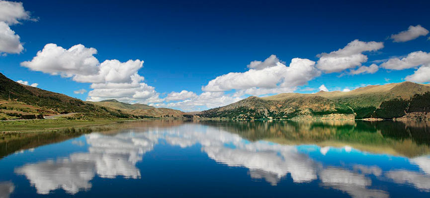
Pallay Punchu is a striped, jagged mountain ridge in the Apu Tacllo massif, on the border between Peru's Canas and Canchis provinces, within the Layo district of the Cusco region. It sits close to Laguna Langui (also referred to locally as the Langui-Layo lagoon), a high-altitude lake whose turquoise water adds a second layer of color to the view from the ridge. The name comes from Quechua: pallay describes the geometric, woven patterns found in traditional Andean textiles, and punchu is poncho — together, "the patterned poncho," a fitting description for a mountain whose slopes look as though they'd been wrapped in hand-woven cloth.
Unlike Vinicunca, which has been a fixture of Cusco tourism since it went viral around 2016, Pallay Punchu is a genuinely recent discovery for the tourism industry — most sources trace its emergence as a hiking destination to around 2020, during Peru's COVID-19 lockdown, when local community members began exploring and documenting the area more widely. It's part of the same broader "rainbow mountain" phenomenon as Vinicunca and Palccoyo, but it remains, as of 2026, a largely local and word-of-mouth destination rather than a mass-tourism one.
Why Pallay Punchu Is So Colorful
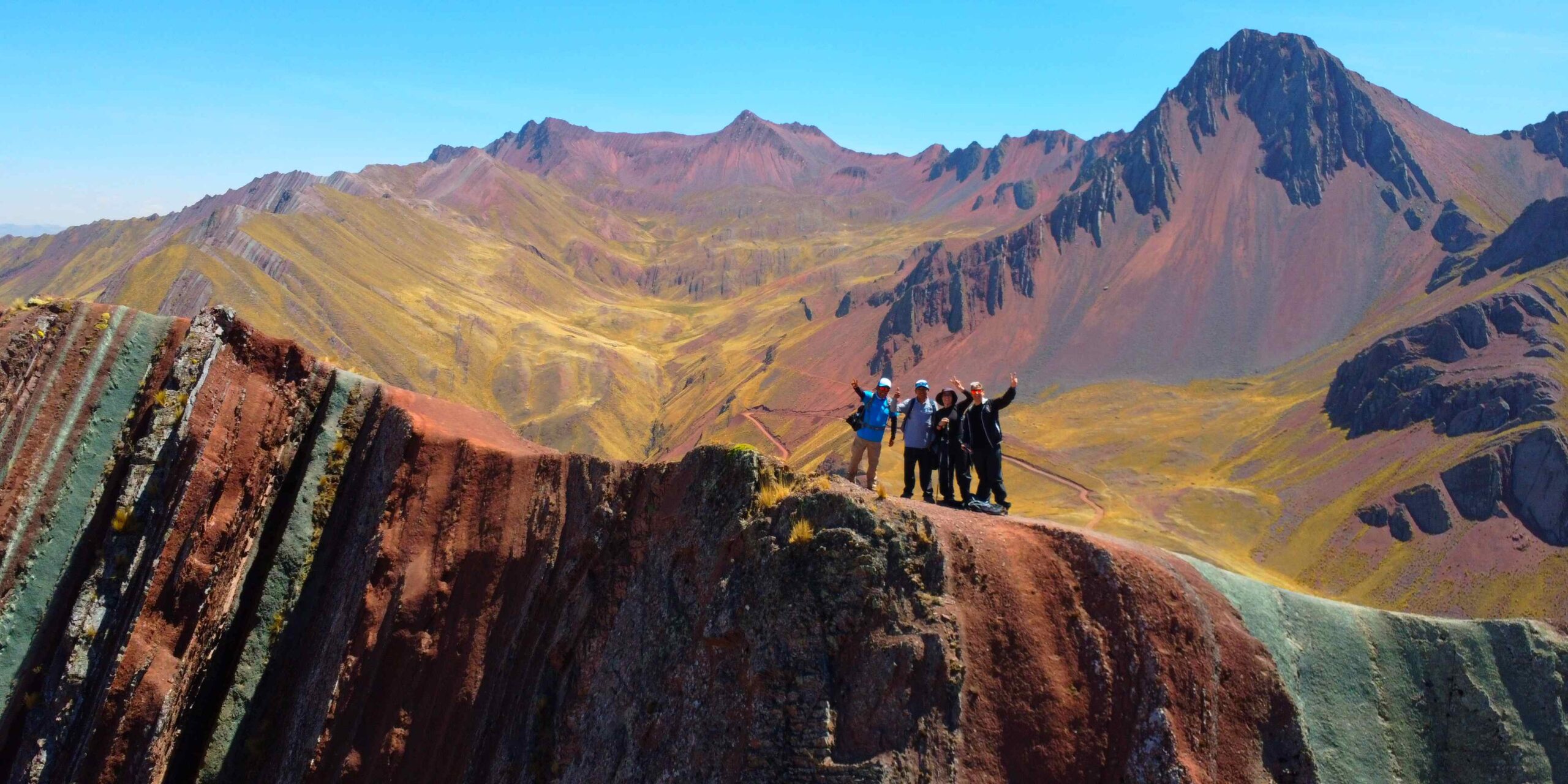
The science behind Pallay Punchu's colors is the same geology that produces Vinicunca and Palccoyo: millions of years of sediment, laid down in distinct mineral-rich layers, later exposed by erosion and uplifted by the same tectonic forces that built the Andes. Each color traces back to a different mineral. Iron-rich clay produces the vivid reds and pinks; limonite contributes the browns and purples; quartz sandstone shows up as streaks of white; and magnesium-rich compounds add green. What makes Pallay Punchu distinctive isn't the chemistry — it's the geometry. Where Vinicunca's colors run in smooth, sweeping bands down a rounded slope, Pallay Punchu's stripes follow sharp, folded ridgelines, giving the mountain a jagged, almost sculpted appearance that many recent visitors describe as more visually striking, if less classically photogenic, than Vinicunca.
Pallay Punchu vs Vinicunca vs Palccoyo
Cusco's three rainbow mountains share the same underlying geology but offer genuinely different experiences. Here's how they compare on the factors that actually affect your trip.
| Factor | Vinicunca | Palccoyo | Pallay Punchu |
|---|---|---|---|
| Altitude at viewpoint | ~5,036-5,200 m | ~4,900-5,040 m | ~4,780-4,800 m |
| Hike difficulty | Demanding — steep, ~3 hrs | Easy — mostly flat, ~1-2 hrs | Moderate — steeper sections, ~1.5-2 hrs (short route) |
| Ridge shape | Smooth, rounded slopes | Gentle rolling hills | Sharp, jagged, blade-like ridges |
| Crowds | Very high — 1,000+ daily in peak season | Low — around 60 daily in high season | Very low — a handful of hikers most days |
| Infrastructure | Ticket booths, fences, horse rentals, vendors | Basic facilities, some horse rentals | Minimal — no fences, no paved trailhead road yet |
| Distance from Cusco | ~100 km / ~3-3.5 hrs | ~120 km / ~2.5-3 hrs | ~190 km / ~4 hrs |
| Best for | First-timers who want the iconic photo and don't mind crowds | Families, slower hikers, easier acclimatisation | Experienced travellers seeking solitude and a wilder landscape |
Getting There and What the Hike Involves
The route from Cusco
Access follows the Cusco-Puno highway (the Pan-American) south through Sicuani (3,550 m), then branches off toward the town of Layo in Canas province. The full drive from Cusco takes around four hours. From Layo, several routes lead toward the colorful sector of the mountain; some are considerably more direct and exposed than others, which is the main reason local guides recommend going with someone who knows the current state of each route rather than navigating independently.
The trailhead and the hike itself
As of 2026, there's still no paved road all the way to the base of the ridge — local municipalities have discussed extending vehicle access, but for now the final stretch is on foot. Most organized day tours use the shorter route: roughly 2.5 km round trip to the main viewpoints, taking about 1.5 to 2 hours at a moderate pace. A longer, full-day alternative starting from the town of Layo covers considerably more ground and genuinely tests fitness and acclimatisation; this version is best reserved for experienced high-altitude hikers travelling with a guide.
What you'll see along the way
The walk crosses open Andean grassland typically dotted with grazing alpaca herds, climbing steadily toward the ridge. From the main viewpoints, the striped slopes of Pallay Punchu sit alongside sweeping views of Laguna Langui below and the wider Vilcanota mountain range in the distance — a combination of colorful geology and high-altitude lake scenery that few other single hikes in the Cusco region offer together.
Best Time to Visit
The dry season, running roughly from May to October, gives the clearest skies and the most saturated mineral colors — the same seasonal window that governs the best time to visit Vinicunca and Palccoyo, and indeed most high-Andes trekking around Cusco. Outside these months, afternoon cloud and rain become far more common, which can flatten the contrast in the stripes or obscure the ridge entirely by the time you reach the viewpoint. Early morning starts are worth it regardless of season: winds tend to pick up over the exposed ridge later in the day, and clear morning light brings out the color contrast best.
Preparing for the Altitude and the Terrain
At around 4,780-4,800 m, Pallay Punchu is lower than Vinicunca but still firmly in serious high-altitude territory — well above the threshold where altitude sickness (soroche) becomes a real possibility for travellers arriving straight from sea level. The standard, well-supported recommendation is to spend at least two to three days acclimatising in Cusco (3,400 m) before attempting any of the rainbow mountains, and to save the highest-altitude hikes, including Pallay Punchu, for later in your Cusco itinerary rather than your first full day in the region.
Practical packing essentials mirror any high-altitude Andes day hike: layered clothing for a wide temperature swing between a cold morning start and strong midday sun, sun protection (UV exposure is intense at this altitude), a hat and gloves for the wind on the exposed ridge, plenty of water, and coca tea or leaves if you'd like to try the traditional local remedy for mild altitude discomfort. Cash in soles is worth carrying for the small community access fee charged at the trailhead, which several recent visitor reports put in the region of S/12-20 per person.
Ask us how it fits your Cusco itinerary.
Before You Go: A Practical Checklist
Acclimatise first, not on the way
Build at least two to three days in Cusco or the Sacred Valley into your itinerary before attempting Pallay Punchu, and ideally do an easier acclimatisation hike first rather than making this your first day at altitude.
Go with a local guide
With no fenced path and several route options of differing difficulty, local knowledge is what keeps this a rewarding hike rather than a risky one — especially on the longer full-day route from Layo.
Start early
Most organized tours leave Cusco very early, often around 4:00 am, to reach the trailhead with good morning light and beat the afternoon wind and cloud that can build over the ridge.
Bring cash in soles
The community access fee at the trailhead checkpoint is typically paid in cash on site; carrying small denominations avoids any issue if the rate has changed since your last check.
Pack for sun, wind, and a big temperature swing
Sun protection, a warm layer, a windproof shell, and enough water for a multi-hour high-altitude walk with limited shade.